How it works
City Cos® is a geolocation, organization, and mobility system that connects aids including maps, signage, digital devices, search engines, post codes, and public transport. City Cos® provides a new mechanism for understanding cities. To make its implementation possible, proprietary systems are designed and prepared by technical experts, through innovative methods and techniques, according to each city’s geographical and population characteristics
Have a look at how City Cos® works on the TedxOporto 2015, RTP1, and RTP2 2015 videos, on our News page.
What it does
Besides the geolocalization function of City Cos®, it also has other characteristics that define it.
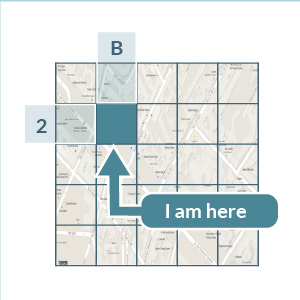
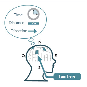
I’M HERE
Enables users to determine where they are.
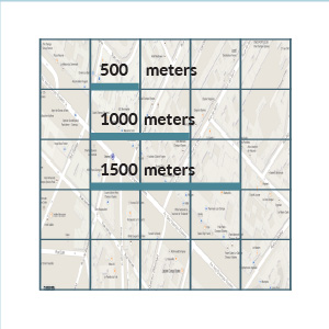
DISTANCE
Enables users to calculate the distance to destinations.
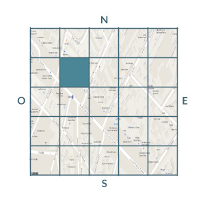
WHERE I AM IN THE CITY
Enables users to determine their location anywhere in the city according to the cardinal points.
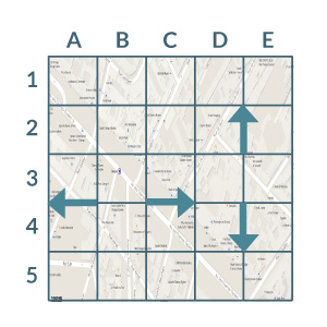
DIRECTION
Enables users to determine their direction of movement.
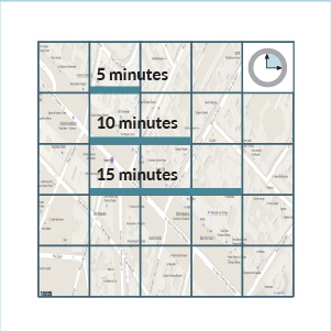
TIME
Enables users to calculate the time to reach their destinations, whether by foot, car, or public transport.
MENTAL MAP
Enables users to orient themselves on the basis of the City Cos® Mental Map they created of the city where they are. It thus works, offline:
Without digital devices (smartphone, tablet);
Without batteries;
Without GPS;
Without wi-fi;
Without roaming;
Indoor and Outdoor.
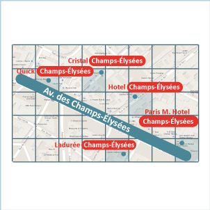
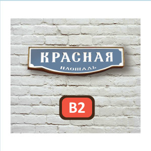
CLARIFIES AREAS WITH THE SAME NAMES
Where streets, gardens, or buildings have the same name, for example Champs Élysées in Paris, the City Cos® coordinate clarifies location doubts by indicating an exact location.
This feature is especially important for the police, fire, and ambulance services, as it can improve response time.
LOCAL LANGUAGE
When used with place name signs, it enables users to orient themselves by the City Cos® coordinates, without having to know the local language.
It can also help a child or anyone else with limited vocabulary to indicate their location.
Possible
applications
City Cos® allows the organization of areas and of people’s mobility, by being applied to public transport, postal codes, or internet search engines.
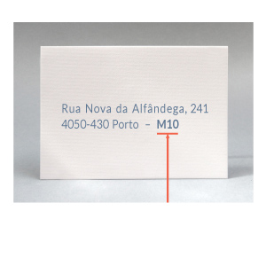
POSTAL CODES
When applied to postal codes, City Cos® coordinates enable addresses to be located.
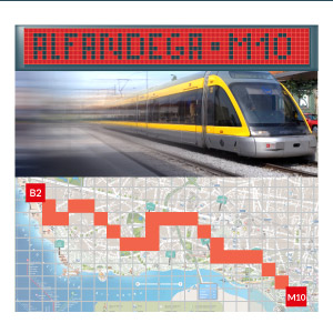
PUBLIC TRANSPORT
When applied to public transport, it enables a destination to be referenced on the basis of the City Cos® coordinates.
Inside public transport, on screen and in real time, the coordinates provide the zone of the city being passed through.
This city map indicates the public transport route from one’s start (M10) to one’s destination (B2).
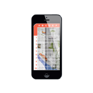
APP — offline
The City Cos® system can be used in the digital environment, access to information being available offline.
Geolocation is done without GPS, Wi-Fi, data or roaming, and there are lists of points of interest including hotels, monuments, restaurants, airports, hospitals, parks, and streets. It also states which points of interest are closest.
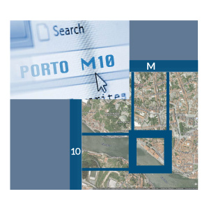
INTERNET SEARCH
When applied to a search engine, to find a location it suffices to write the name of the city (Porto), with the coordinate of the location (M10), without it being necessary to write an address.